Home/How Menai Civil facilitates quick communication between the office and the field
How Menai Civil facilitates quick communication between the office and the field
Menai Civil uses Trimble Stratus, Powered by Propeller. Trimble, the global leader in positioning technologies, was an early partner of Propeller. With SITECH Solutions, we work to deliver Trimble Stratus’s survey-grade drone data solutions for the construction industry.
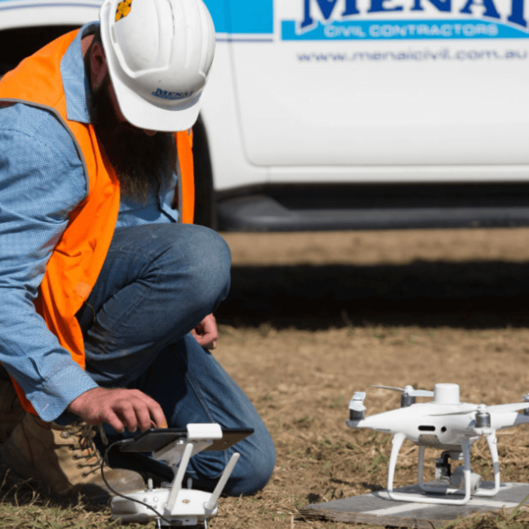
Menai Civil Contractors has delivered large-scale heavy civil projects in and around Sydney, Australia, since 2002. With about fifteen active projects at any given time, Survey Manager Brendan Lawrence and his small team of surveyors stay busy answering the site teams’ questions about active earthmoving and road upgrade sites.
Menai Civil is focused on using cutting-edge technology to deliver the highest standard of quality and productivity on their sites. When Brendan joined the team seven years ago, one of the first questions he remembers hearing in his interview was, “Have you ever used a drone?”
In this customer story, we’ll share how Brendan went from thinking of drones as “toys” to considering them a critical part of his day-to-day workflow.
14
users
13
surveys processed
76
measurements created
The problem: Slow processing speeds and siloed data
When Brendan first started flying drones for Menai Civil, he processed all the data himself. While the flights themselves were quick, self-processing presented several challenges:
- Data delays: While drones could survey Menai Civil’s worksites in under an hour, it still took days to give the site teams the answers they needed. “The team saw me do the drone flight, which was really quick, and then they didn’t understand why it was taking so long to get the data to them. But the processing was the hard and tricky part,” said Brendan.
- Siloed data: When the data finally finished processing, it was all stuck on one computer. Sharing orthophotos was a grueling process involving huge files that took a lot of work to send and access.
- Unreliable ground control: Processing wasn’t the only thing Brendan did manually; he also laid out ground control he made himself, placing 10 targets across each worksite before surveying. This process was slow, with the opportunity for unforeseen errors. “I lost about a target a month because the dozer operators don’t always see them on the ground. They’d get run over or buried,” Brendan said.
- Inaccurate material volumes: Before Menai Civil started surveying with drones, they completed monthly ground surveys to tell them how much dirt they’d moved and how much was left to go. With so much time between surveys, cut/fill quantities were often rough estimates based on truckload counts, which were often inaccurate.
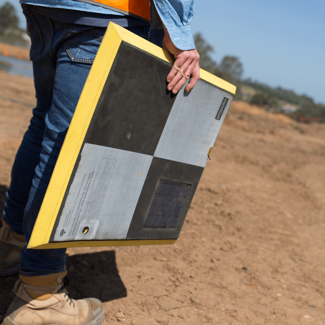
Brendan with the wooden GCPs he created before using AeroPoints
The solution: Cloud-based software anyone can access
Menai Civil cites cloud-based processing as their biggest win. Using Propeller’s PPK workflow, the team now surveys big earthworks projects once a week to keep them on track. Sending their data processing to Trimble Stratus frees up Brendan and his team to survey more sites, more often, getting teams the data they need to make better decisions.
“The old way, we were lucky to get the data back in a few days. Now, I sometimes fly five sites in one day and all the data is back the next day. It frees up the rest of your week because you’re only spending one day out in the field. The rest of the week, you’re not stuck processing and getting data out.”
AeropPoint as a GCP
Menai Civil’s most-used features and workflows:
- Propeller PPK: With Propeller’s PPK workflow, Brendan only needs one AeroPoint (our smart ground control points) on the ground to serve as a combination base station and ground control point (GCP). “With PPK, we don’t have to worry about spacing out ground control or losing targets,” Brendan said.
- Quality control: Menai Civil still uses checkpoints to verify survey accuracy, but they also rely onTrimble Stratus’ robust QA process, which checks their results against previous surveys to keep data quality high.
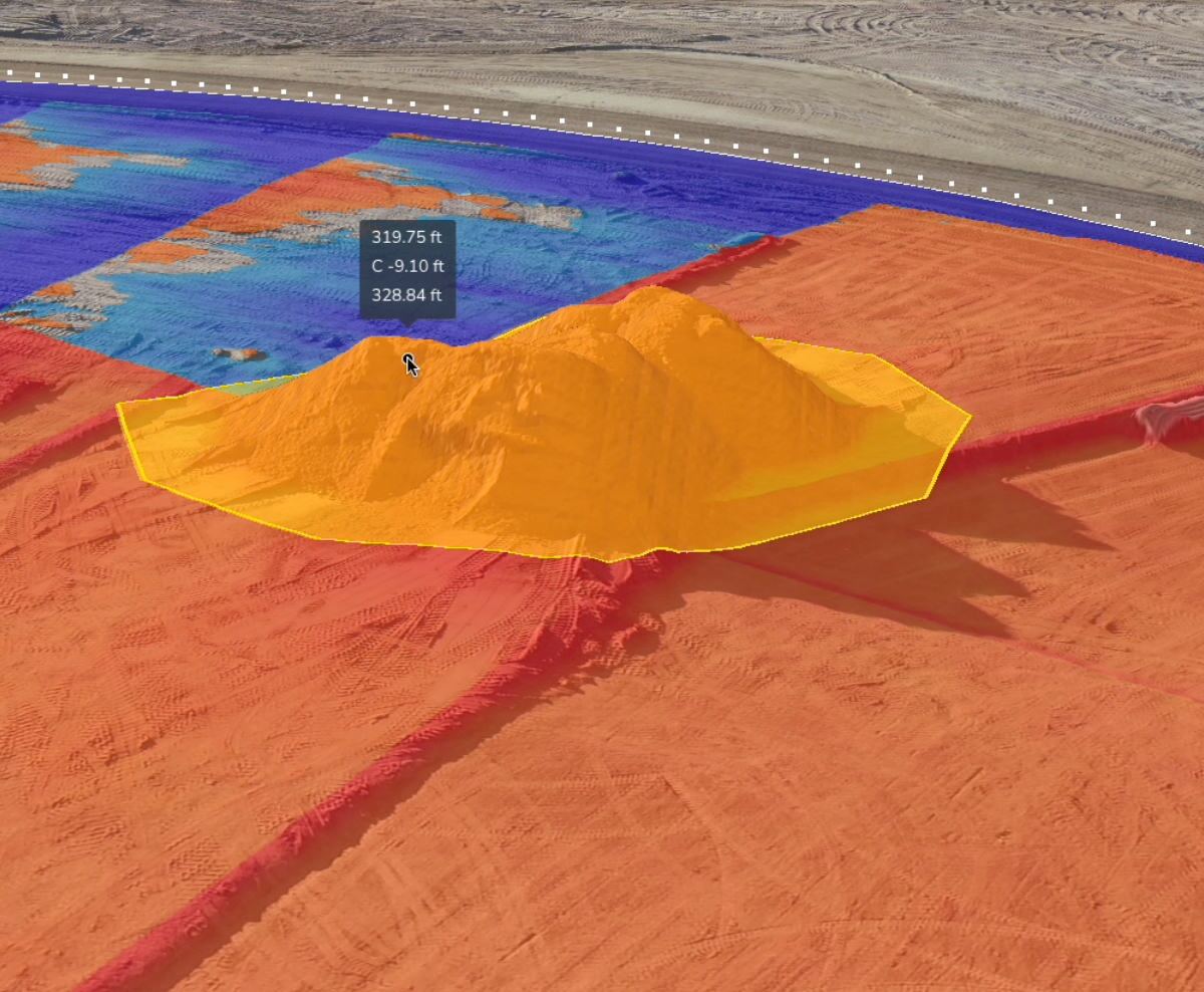
- Volume measurements: With direct access to survey data, the team is free to make any measurements they’re interested in, from surface areas and elevations to cut/fill and stockpile volumes.
“As soon as the data is available, our team can jump on and get volumes themselves. They’re not fully reliant on me to get the data to them, and they can see everything a lot easier with a 3D map of the site they can zoom around.”
- Tracking material movement: On a recent residential project in Sydney, Menai Civil used Trimble Stratus powered by Propeller to calculate material volumes of existing stockpiles to determine whether they’d have to import material from elsewhere.
- Mobile-friendly media: Brendan loves the ease and versatility of attaching geotagged images to specific locations on-site for easy sharing. As images are uploaded to Trimble Stratus from the mobile app, they’re automatically attached to a specific geolocation and tagged with the date and the name of the person who uploaded them. “Without having to drive to the site, the guys in our head office can just click and look at a few photos to see what’s happening on the ground,” said Brendan.
- Whole site surveys: With flight times as short as 10 minutes to survey an entire site, Menai Civil can capture details they don’t even know they’ll need with every flight.(Read the section on preventing rework below to learn how this extra data comes in handy.)
“Having a cloud-based platform for our survey data is where we see the greatest advantage of Trimble Stratus. Our data is available to all of our site teams as soon as it’s ready.”
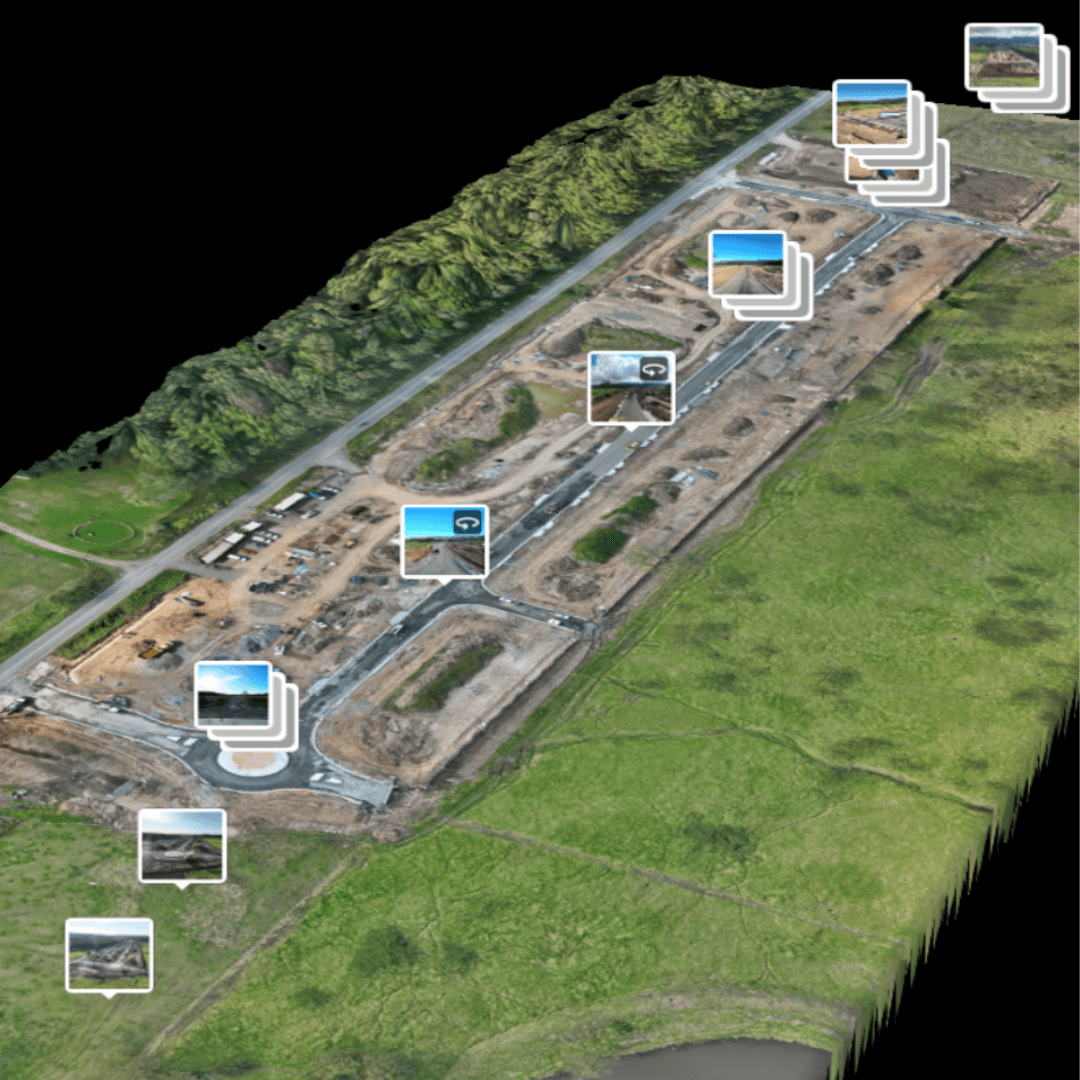
Media on the map
The results
Sharing direct access to Trimble Stratus’ browser-based platform with clients and stakeholders helps Menai Civil improve communication and show proof of work. “It helps us win more work with the same client because they’ve got visibility into the operation,” Brendan said. And this level of access is paying off; nearly all of Menai Civil’s work comes from repeat client business.
Other worksite wins include:
- Accuracy: Menai Civil’s surveys aren’t just safer and faster to complete with Trimble Stratus—they’re also more accurate. “You’re never going to get a perfect survey walking over stockpiles with a base and rover,” said Brendan. Trimble Stratus helps the team capture the time savings of drones—with better accuracy to boot.
- Productivity: Without Brendan and other surveyors placing physical targets throughout a worksite, there’s no need to interrupt ongoing earthwork to complete surveys. “The guys can just keep going, without slowing anything down,” Brendan said.
“Trimble Stratus lets us take action earlier. Before, we would have had to stop ongoing earthwork to re-survey and resolve design discrepancies. Now, we’re finding issues before we even start the work on-site.”
- Safety: Skipping manual GCP placement has also made Menai Civil’s worksites safer, because the team no longer has to drive around placing targets. If there’s an added safety concern, like an unstable stockpile or contaminated materials on-site, Brendan and his team don’t have to set foot there at all. “We can just do it from the outside, and no one even has to know that we’re there,” he told us.
- Preventing rework: While reviewing one full-site survey in Trimble Stratus, Brendan happened to notice that a sewer shaft was installed in the wrong spot. The plumber blamed Menai Civil’s markings, but Brendan had the data to prove they weren’t at fault. “I went back using the Timeline slider on Trimble Stratus to see if I could find any evidence of when it was built, and I found the pegs we used to set-out that sewer shaft had been captured by the drone. I did a measurement, and you could see the offset of several meters between where we marked it and where it was built.” With visual evidence to prove their case, the plumber completed the rework and moved the shaft.
“Trimble Stratus gives us a quick turnaround from what’s happening on the ground back to the site team. We’ve never had that level of visibility over all our sites before.”
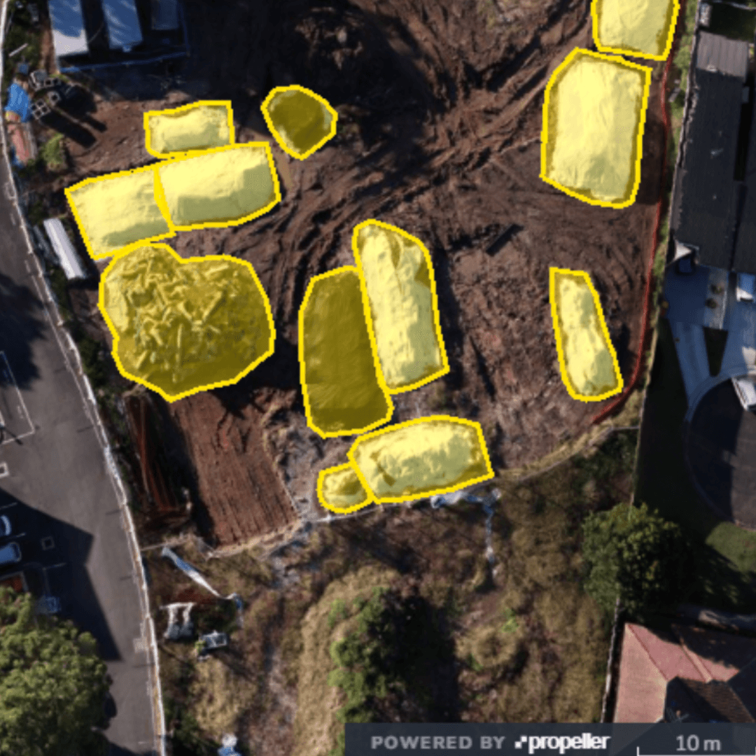
Stockpile measurements
Want to know how Propeller can help you?
Learn more about Propeller’s products, pricing, and how to get started on your site.