Home/Bonatti is carving out a competitive edge on pipeline projects worldwide
Bonatti is carving out a competitive edge on pipeline projects worldwide
As an international contractor, Bonatti has provided their services to the worldwide energy industry since 1946. Today, they work across four continents, with headquarters in Parma, Italy, and a team of 8,500 employees around the globe. Their main projects include EPC (Engineering, Procurement, and Construction) and standalone construction of plants and pipelines.
Field Engineering Manager Francesco La Gaetana and Pipeline Engineer Gabriele Galletti serve as unofficial “Propeller ambassadors” within Bonatti. As early adopters within the firm, Francesco and Gabriele form a link between Italy-based engineers and ongoing pipeline construction, currently taking place at an oil field in southern Iraq.
Read on to learn how Bonatti uses Propeller to keep fresh survey data at their fingertips – and easily share it – while managing large-scale projects that span continents.
The problem: Labor-intensive land surveys
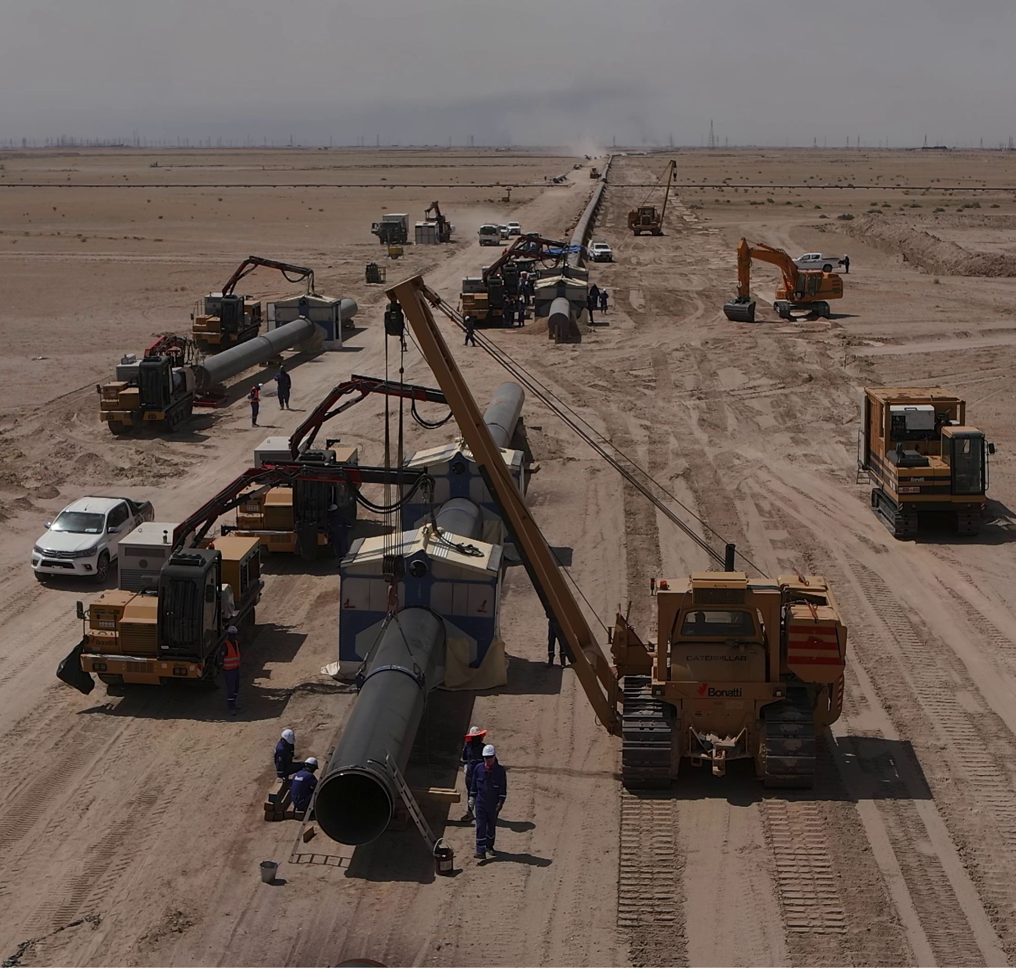
Before Propeller, Bonatti’s surveying was done exclusively by land surveyors using either GPS RTK or total station. While they still use traditional survey methods for detailed works, their old workflow posed a few problems when it was the only option:
- Slow data acquisition: traditional survey methods for pipeline works are quite slow and, consequently, expensive. The team relied on lots of site visits between surveys to keep projects on track.
- Rapid site changes: Bonatti’s worksites are particularly complex, and the site is constantly changing interfering with external stakeholders. Without frequent surveys, it was hard to track every site change that could cause re-design or re-works. Francesco explained: “The site is huge; we can’t physically check it every day.”
- Technical barriers: Surveys could only be processed and read by trained experts using specialized software on expensive equipment, effectively gatekeeping Bonatti’s survey data.
- Limited sharing: For the same reason, sharing data with internal and external stakeholder was difficult. With everyone working in their own system and using their own tools—located in countries on the other side of the world—miscommunications were all too common.
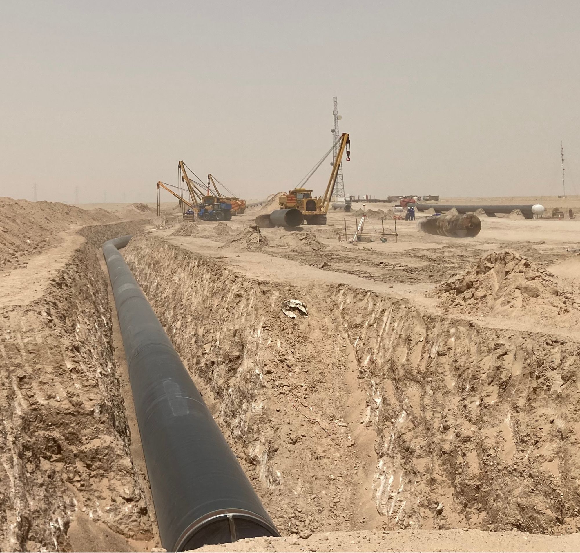
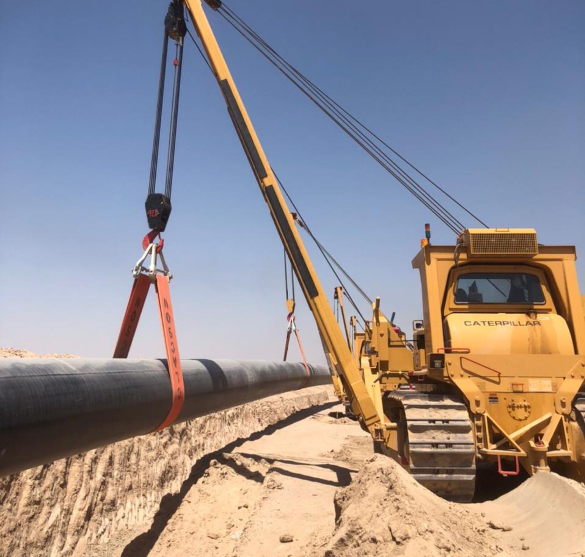
The solution: Large-scale surveys that take hours, not days
Francesco and Gabriele first encountered Propeller while working on a pipeline project in Canada, where one of their partners used drones to survey the project site regularly. The Bonatti team immediately recognized the benefits and implemented their own drone surveying workflow.
Francesco describes Propeller as “very professional with all the functionality we need, but still user-friendly,” which gives it a significant field advantage over CAD tools and other technical software. “We give our team access to Propeller, and within 30 minutes, they understand how to use it,” Gabriele said.
“We still have survey crews with GPS RTK and total station, but Propeller helps us do in a day what a land survey can do in a week. We accumulate a huge amount of data with the same accuracy but in a shorter time.” – Francesco La Gaetana, Field Engineering Manager
Bonatti’s favorite features and workflows
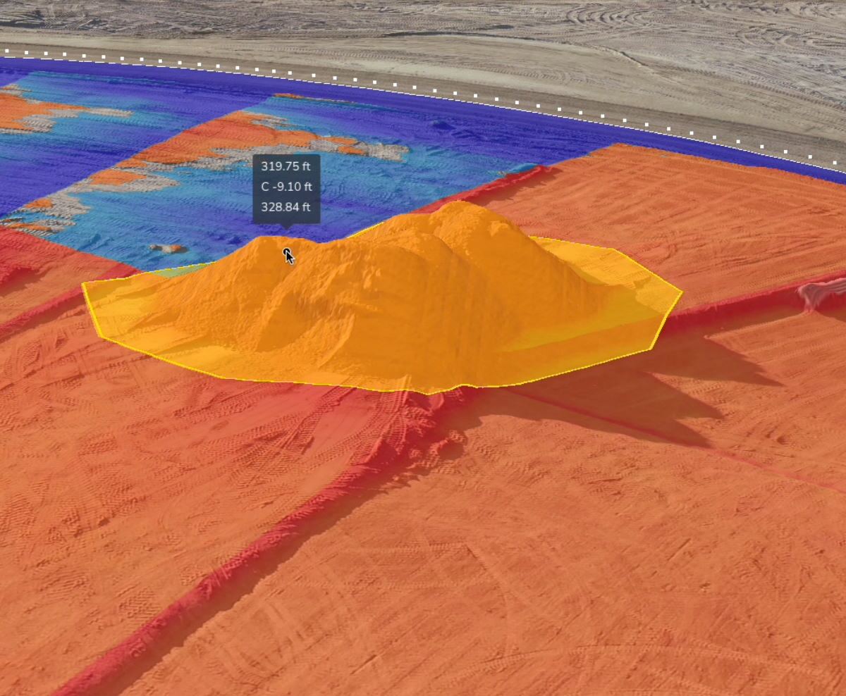
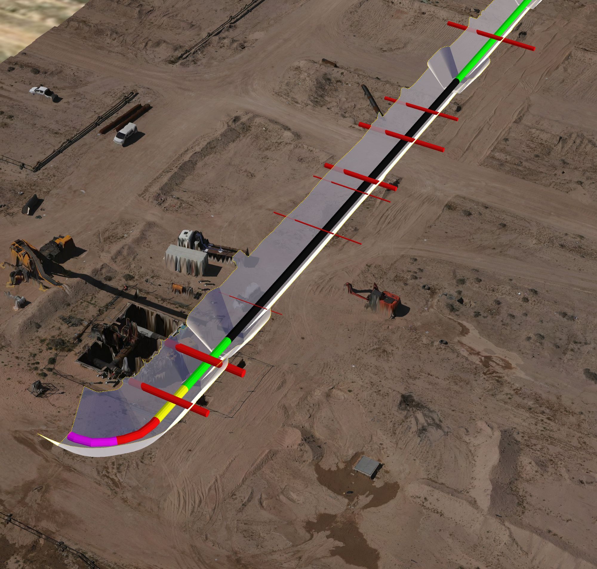
- Interactive overlays: Bonatti uses Propeller as a GIS tool to overlay designs, media, and other data on a realistic 3D map of their worksite.
- Proof of work: With the Timeline feature, Bonatti can identify and track site conditions at each stage of work. Gone are the days of completing out-of-scope rework; now, they have the data to show how the site is changing and proactively flag potential sources of rework.
- Browser and mobile access: With 3D maps based in the cloud, all stakeholders have instant access on any device—including the phones and tablets they use in the field. “A very simple thing that all users can do is to make measurements and review designs inside the survey,” said Francesco. “It’s an instant check for what’s happening in the field versus the design.”
- Media: The team uses Propeller’s Media tool to upload photos to the map during site visits, giving them an easy way to share time- and location-stamped photos without getting bogged down in email or text. With all of their on-site data and related media in one place, everyone stays up-to-date.
- Data exports: Gabriele also appreciates the ability to extract just one part of a site surface for closer analysis at a higher resolution.
“I always have Propeller open, so if someone comes and asks me a question, I can answer it right away.” – Gabriele Galletti, Pipeline Engineer
The results
Francesco sums up Bonatti’s current use of Propeller this way: “We use it to overlay survey data into a unique platform and share it easily with a large number of stakeholders, regardless of technical knowledge.” He adds, with a laugh, “I definitely recommend it—but not to our competitors. We want to keep our advantage.”
“When we start a new project, we definitely need Propeller. I would not give up all these new features Propeller gives us.” – Gabriele Galletti, Pipeline Engineer
Almost every stakeholder on Bonatti’s Iraq pipeline project now uses Propeller, from the safety and security team to engineers and field workers. Here are just a few of the results:
- Better coordination: The frequent, accurate surveys made possible by Propeller have become an integral part of Bonatti’s daily workflow, improving project coordination at all levels. “For us, it represents a revolutionary milestone,” Francesco said.
- Faster data at scale: Bonatti’s large-scale linear projects require vast amounts of data, which they now tackle from two sides: regular benchmarking with Propeller, with accuracy they can scale up or down using ground control points density; and traditional land surveys done much further apart. “With Propeller, we can do in one day what a traditional survey can do in a week,” said Francesco.
- Easy data sharing: Before Propeller, Bonatti still shared a few printed documents to distribute data, alongside a mix of digital mediums that were hard to track. Now, they can share with both internal and external stakeholders in one click.
“The easiest way to answer stakeholder questions is in Propeller. The data is understandable to everybody.” – Francesco La Gaetana, Field Engineering Manager
- Digital site visits: While Gabriele and Francesco can’t be everywhere at once, Propeller’s interactive 3D mapping lets them be onsite even when they aren’t. When they do notice issues in the field, they can share them instantly with engineers back in Italy.
Want to know how Propeller can help you?
Learn more about Propeller’s products, pricing, and how to get started on your site.