![]()
“Once you’ve used Propeller, you don’t want to use anything else again. It’s so easy!”
– Robin Stenström, CEO at Steax
With Propeller, you can unify your plans, field data, machines, and people on a single map — from ground to cloud. Get the job done right the first time, every time.
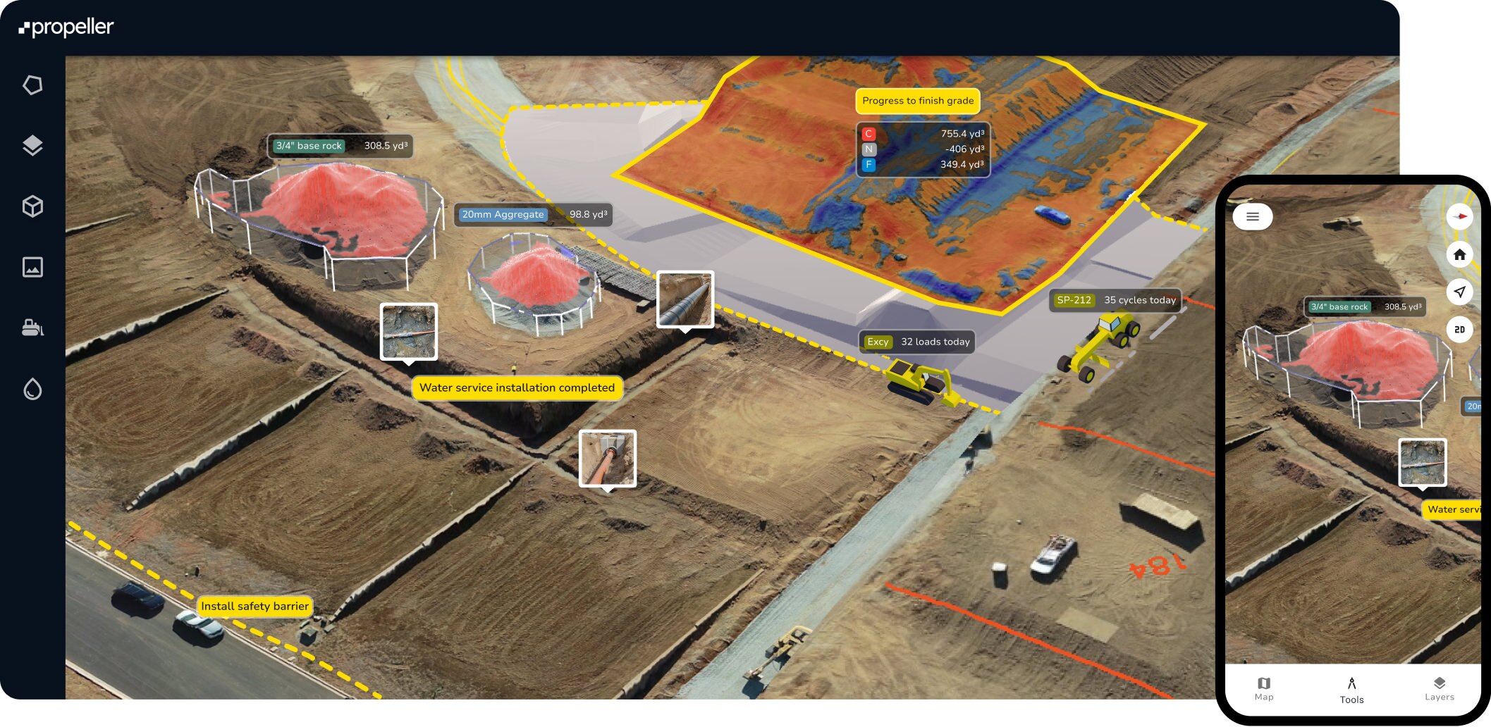
Manage your design surfaces, plans, surveys, and field data from a single platform, replacing data silos with on-demand insights.

Bring everyone together with one shared source of truth. With complete transparency and easy access, your team can collaborate better, make smarter decisions, and get the job done faster.
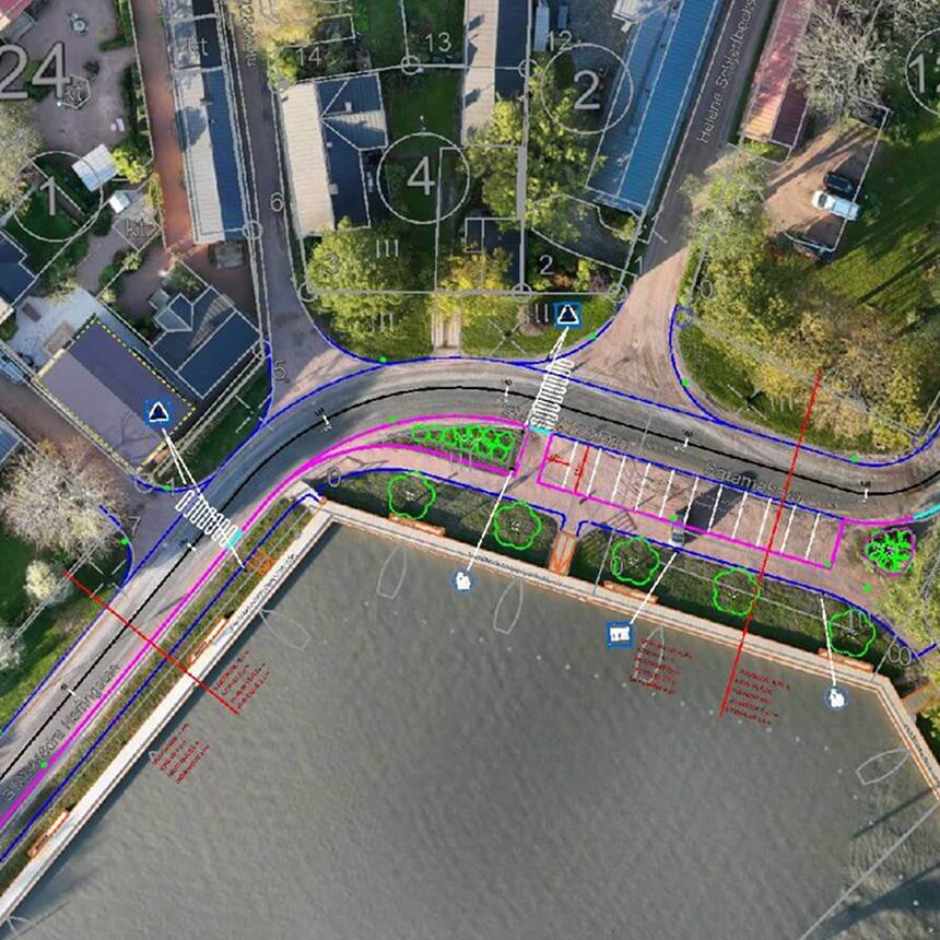
Leverage data from any survey equipment—machines, drones, GPS rovers, laser scanners, or total stations—to calculate volumes, measure elevations, and compare current site conditions to future designs or past surveys with ease.
Stay ahead with daily insights into your progress, pace, and what’s left to do. Identify inefficiencies quickly, streamline your workflows, and keep your projects moving forward—on time and on budget.
From progress updates to data management, these tools help teams stay in control and on schedule.
![]()
– Robin Stenström, CEO at Steax
Keep using the tools you know. Propeller easily connects with your favorite software and supports the data formats you already work with, so you can get even more out of your existing workflows.
Propeller Scale brings advanced organization, security, and integration capabilities to our standard platform experience to streamline geospatial workflows across large teams.

Restrict user access to private workspaces gives you more control over how information is shared within your organization.

Stream orthophotos from your site directly to your GIS software.

Query information about your sites and surveys to pull terrain files into your CAD and GIS platforms automatically.
Meet the tools and features behind the map.
Distance
Measure point-to-point distances.
Elevation
Track height changes across various captures or at a specific point.
Elevation difference
Calculate height differences between points.
Cross section
Generate cross section charts of designs and surveys.
Surface area
Measure surface areas within any polygon.
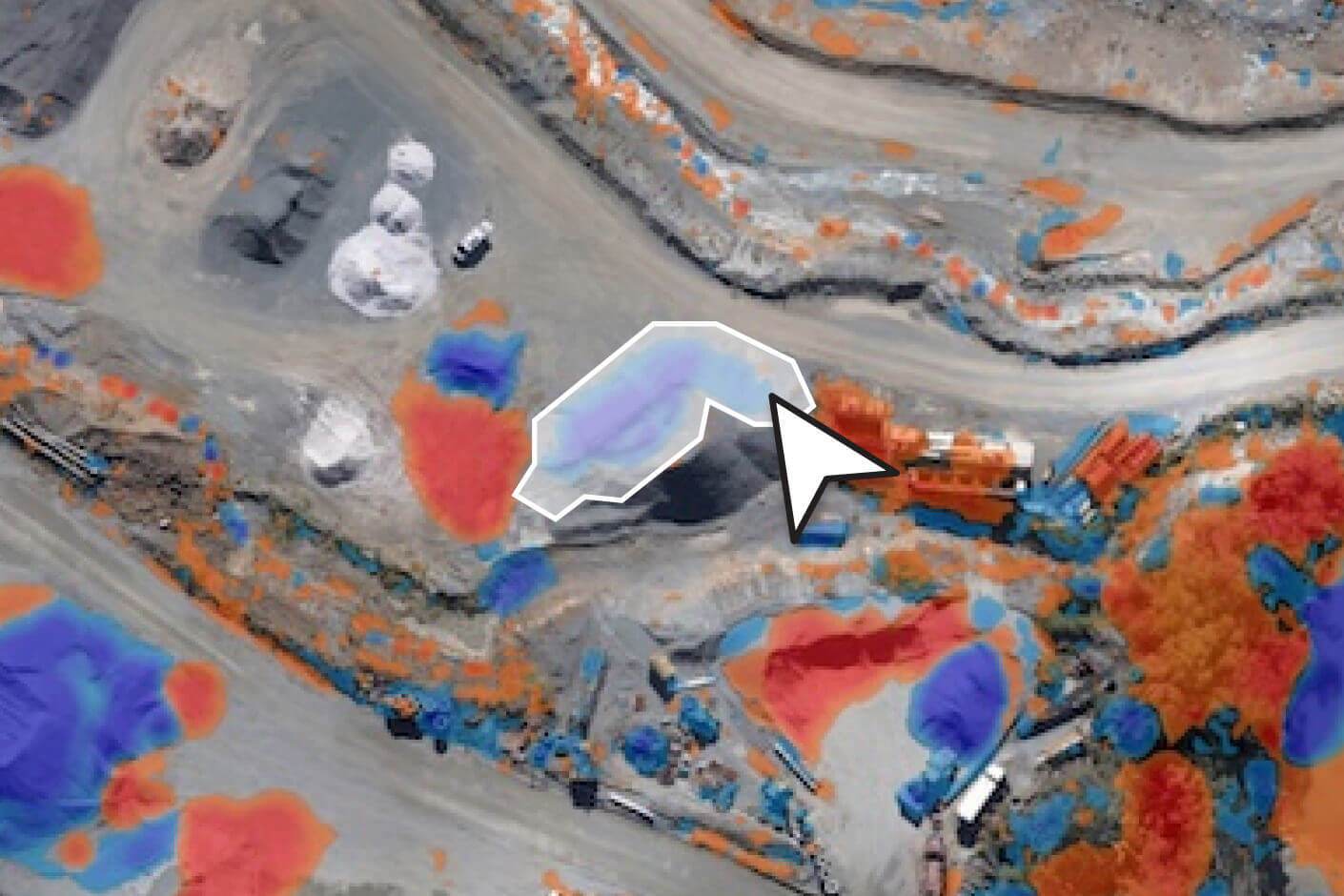
Stockpile
Quickly measure stockpile volumes and create reports.
Shrink/swell calculator
Account for the shrink and swell of soil for more accurate load calculation.
Survey explorer
Combine survey data to plan and review.
Composite builder
Merge multiple survey captures into a single measureable map.
Timeline
Visualize how your site has changed over time, between survey captures.
3D + 2D viewing
Explore a digital twin of your site in 3D or 2D.
Crop and cleanups
Easily crop maps and remove obstructions.
Map layers
Toggle between your terrain model, orthophoto, camera positions, and point cloud.
Base map
Designate any surface as your base map to begin measuring and tracking site activity.
User permissions
Securely share projects and surveys with adjustable access levels.
Workspaces
Easily organize your design and measurement files for quick access.
Custom homepage
Group sites or star favorites for faster access.
Folders
Organize measurements into folders via drag-and-drop.
Read-only public API
Query site and survey data to pull terrain files into CAD and GIS platforms.
Web Map Tile Service (WMTS)
Stream orthophotos from your site directly to your GIS software.
Imports/exports
Import and export surveys, surfaces, and reports.
Flood level
Visualize flood impacts at specific levels.
Surface ruined
Map water flow directions across your site.
Watershed analysis
Identify water catchment areas quickly.
Direct rainfall simulator
Simulate runoff from rainfall events.
Scheduled reports
Automate daily email reports with load/cycle data, a volume heatmap, and a 7-day volume chart.
Media
Pin images and 360 photos to an exact location on the map from the field.
Crew
Share your map via a unique URL on any device.
PDF map
Export plotter-ready map printouts.
Measurement report
Create customizable PDF reports of your site data.
Timelapse
Export progress videos showing site changes over time.
Flythrough
Create dynamic flythrough videos of your site.
Takeoff map
Generate reports comparing surveys with design surfaces.
Markup
Add, style, and share labeled points and freehand scribbles on the map in real-time.
Platform analytics
Monitor Propeller usage across your organization.
Propeller mobile
Visualize your live location against designs, perform critical site checks, and share real-time updates—all from your mobile device.
Utilization view
View utilization data for all DirtMate machines in a table, including run/idle time, load count, and dump count.
Machine location and trails
Identify slow-moving or inactive machines with color-coded trails and real-time location tracking.
Speed analysis
Track average, minimum, and maximum speeds to ensure fleet efficiency.
Smart cycles
Review cycle length, duration, and total cycles for each DirtMate machine.
Point of interest
Drop points on the map and add contextual details.
Hazard
Mark safety hazards and assign severity levels.
Grade check
Assess grades as degrees, percentages, or ratios.
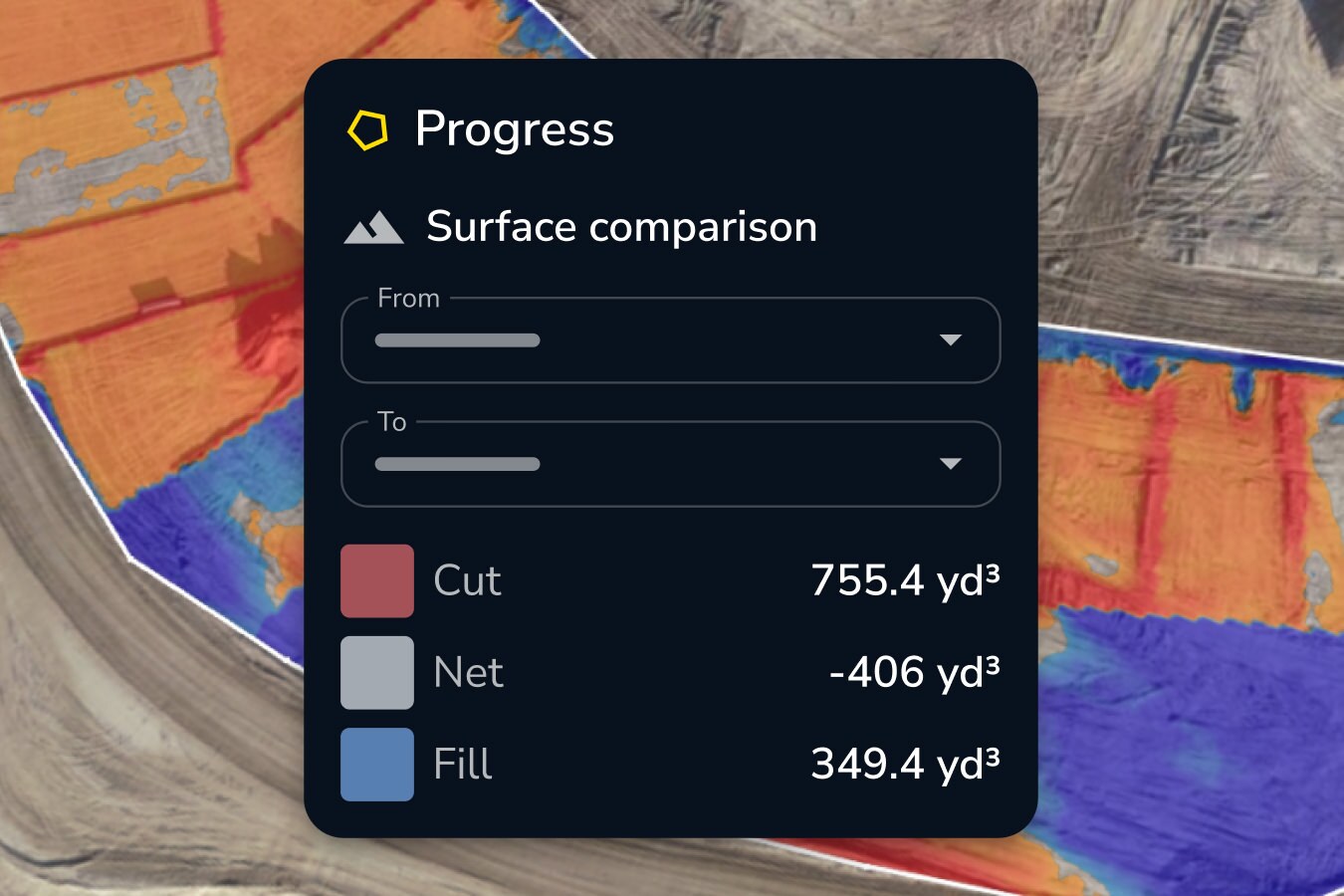
Cut-fill
Compare any two surfaces to track progress or changes in volume over time.
Area progress
Compare site progress against previous surveys or designs.
Material properties
Track materials with tonnage and cost reports.
Surface comparison
Compares surfaces, design-to-design, survey-to-survey, or survey-to-design, to track progress or plan ahead.
DirtMate surfaces
Stream real-time surface data and production volumes on the map.
Explore Propeller’s automated workflows built to eliminate repetitive tasks like stockpile measurements and terrain cleanups.
Expand your toolkit with smart, simple solutions that make every job easier to manage.

With fast turnaround times and seamless integration into your workflows, you’ll spend less time waiting and more time making decisions. Upload, process, and access your site data with ease—no complex tools or lengthy processes required.
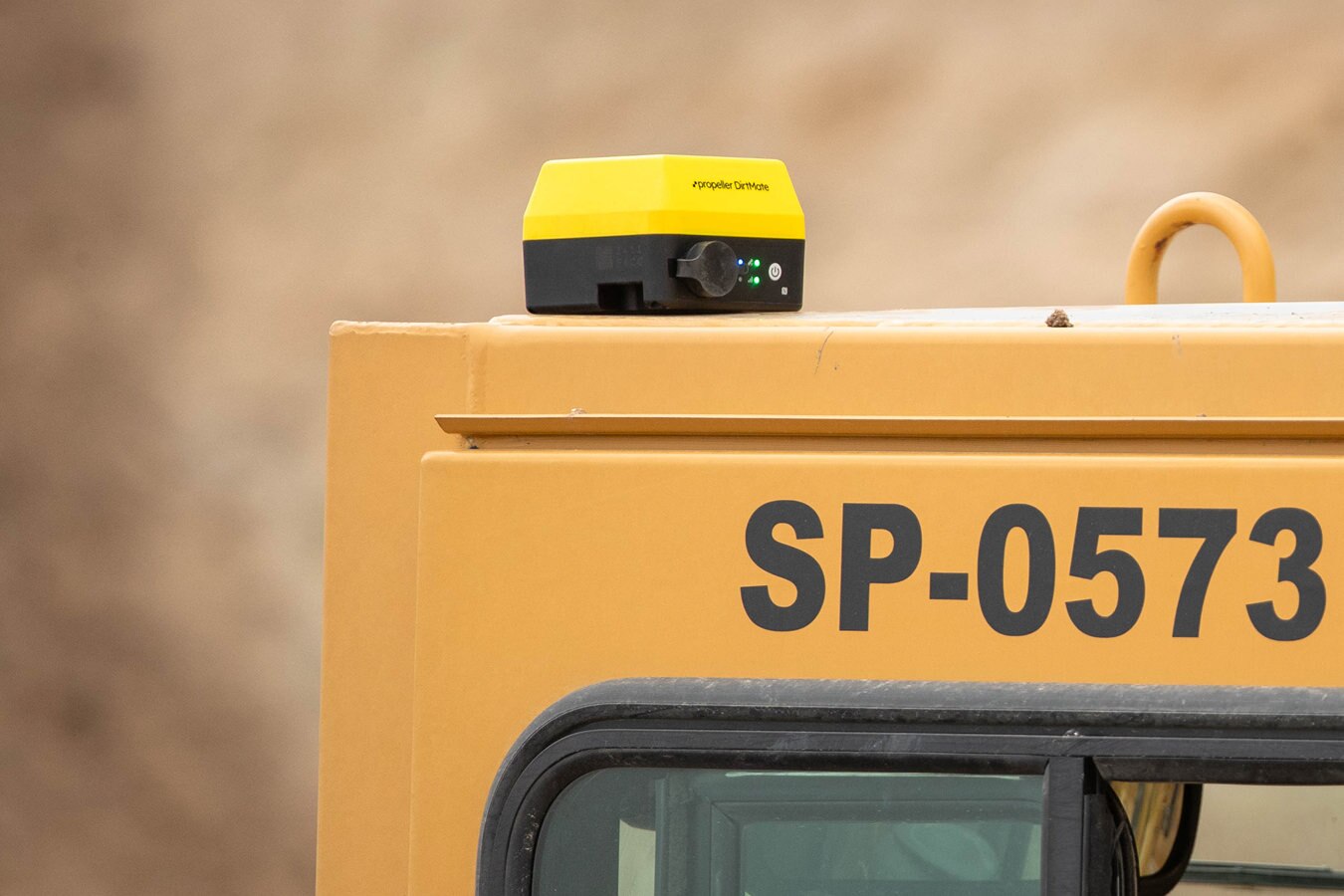
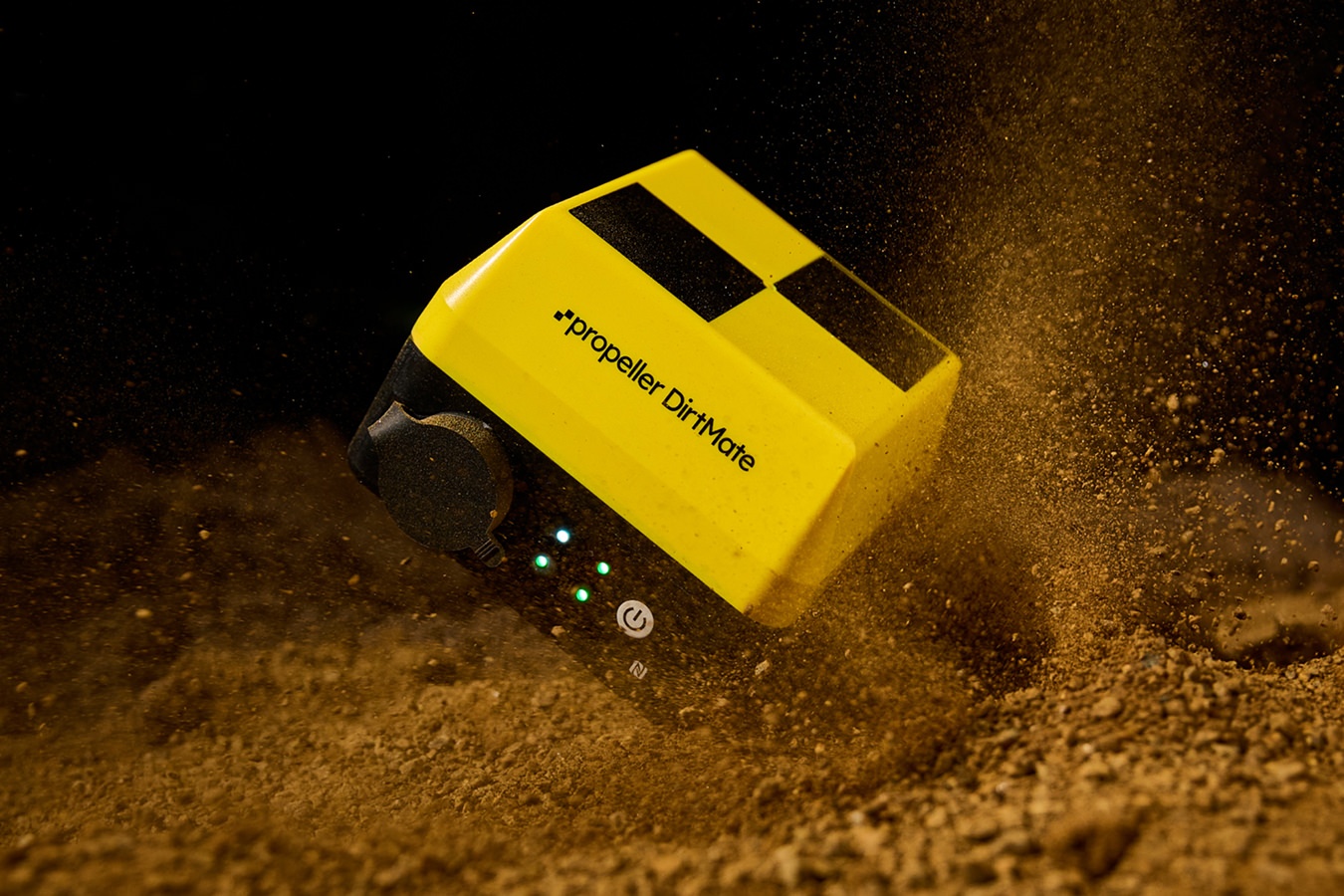
DirtMate is a GNSS system with an onboard IMU that unlocks machine tracking and real-time survey solutions in Propeller. Live stream site activity to know your real-time position against project goals—no surprises.
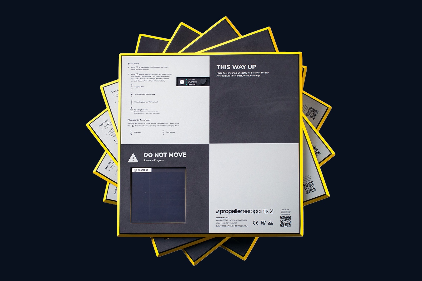
These ground control points are designed to make drone surveys accurate and effortless. Durable, lightweight, and self-contained, they simplify your setup while delivering results you can trust.