fbpx

Construction.
Powered by Propeller.

Empower your project teams to
measure and manage site activity
from just one map.
Empower your project teams to measure and manage site activity from just one map.
Trusted by
See how Propeller can transform your job – for the better.
I’m a site contractor
I’m a general contractor

Work smarter, win more.

Reality capture
meets survey data.

From data capture to project management, Propeller takes the guesswork out of sitework.

  • Capture survey-grade topos.
  • Know your site, inside out.
  • Access on-demand quantities from any device.
  • Track earthworks progress with ease.
  • Keep your site on record to avoid disputes.
  • Generate and share reports in seconds.
  • Level up on site safety.
  • Capture survey-grade topos.
  • Know your site, inside out.
  • Access on-demand quantities from any device.
  • Track earthworks progress with ease.
  • Keep your site on record to avoid disputes.
  • Generate and share reports in seconds.
  • Level up on site safety.

From planning to managing subcontractors, level up your organization with one powerful collaboration tool – a map.

  • Bring your team together with a single map.
  • Centralize your project documentation.
  • Streamline operations with an up-to-date view.
  • Bring transparency to your client and subcontractor relationships.
  • Visualize and measure how you’re pacing against designs.
  • Keep your team out of harm’s way.
Es wurden keine Ergebnisse gefunden, die deinen Suchkriterien entsprechen.

The industry landscape is changing, fast.

Site engineers, managers, and their teams are revolutionizing the way they map, measure and manage their sites – with the help of Propeller.
10,000
Users are working smarter
1
Countries are surveying faster
10,000
Sites are powered by Propeller
Dig into our workflows.

See our products in action.

Autodesk Innovyze

Verwenden Sie bei Ihrer Arbeit als Wasserprofi eine Drohne? Wenn sich das ungewöhnlich anhört – aber auch ein bisschen faszinierend – dann ist dies genau das Richtige für Sie.

Mike Elliott

Regional Sales Manager, RMUS

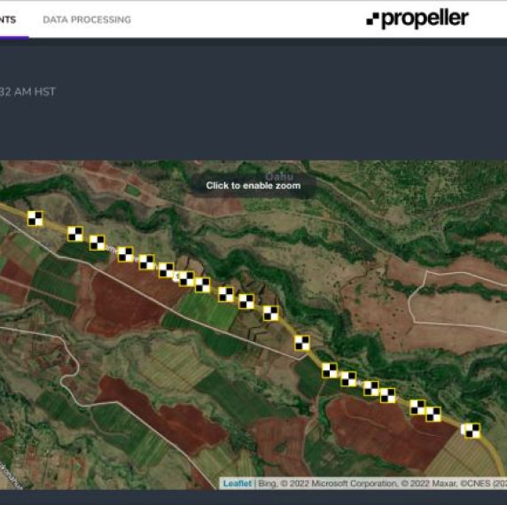
Ein weiteres Straßenkartierungsprojekt heute. 3,5 Meilen und 3 separate Befliegungen der Baustelle mit Propeller’s Aeropoints. Propeller hat die Daten für uns verarbeitet und die DJI M300 RTK P1 Kamerabilder zusammengeführt. Wir freuen uns darauf, das Ergebnis mit unseren Kunden teilen zu können.
Terry Henry

Senior Field Engineer, The Beck Group

Im Büro der Beck Group in Austin gibt es viel zu tun. Implementierung von Propeller mit der DJI Mavic 3E, um den Baustellenverlauf im Blick zu haben und Entwürfe überprüfen zu können. Eine unschlagbare Lösung! #Propeller #DJI

Jebo Aho

GPS Engineer, ECS Development, LLC

Hier sind ein paar Bilder, die unser Drohnenbeauftragte in unseren aktiven Wohnanlagen aufgenommen hat. 

Michael Clark

Director Field Engineering, Rogers O’Brien Construction

Nachdem ich fast 2 Jahrzehnte im Baugewerbe gearbeitet habe, ist es inspirierend zu sehen, wie weit die Technologie in der Branche gekommen ist. Ich liebe es, für ein Unternehmen zu arbeiten, das an der Spitze der Innovation steht und sich dafür einsetzt, die Technologie zu nutzen, um den Arbeitskräftemangel zu überwinden, mit dem wir konfrontiert sind. Wir haben Propeller ein paar Monate lang ausprobiert, um zu sehen, ob es eine praktikable Lösung ist, um die Geschwindigkeit und Qualität unserer Vermessungen zu erhöhen, und ich kann Ihnen sagen, dass mich dieses Programm definitiv überzeugt hat.

Want to see more? Check out this line up.

Training + Support
Get set up for success, right from the get-go.
Man placing AeroPoint on the the ground of a site before drone survey
AeroPoints
Gather and upload accurate ground control data without fuss.
DirtMate attached to a machine
DirtMate
Zugriff auf genaue Baustellendaten und Einblicke in die Effizienz in Echtzeit.