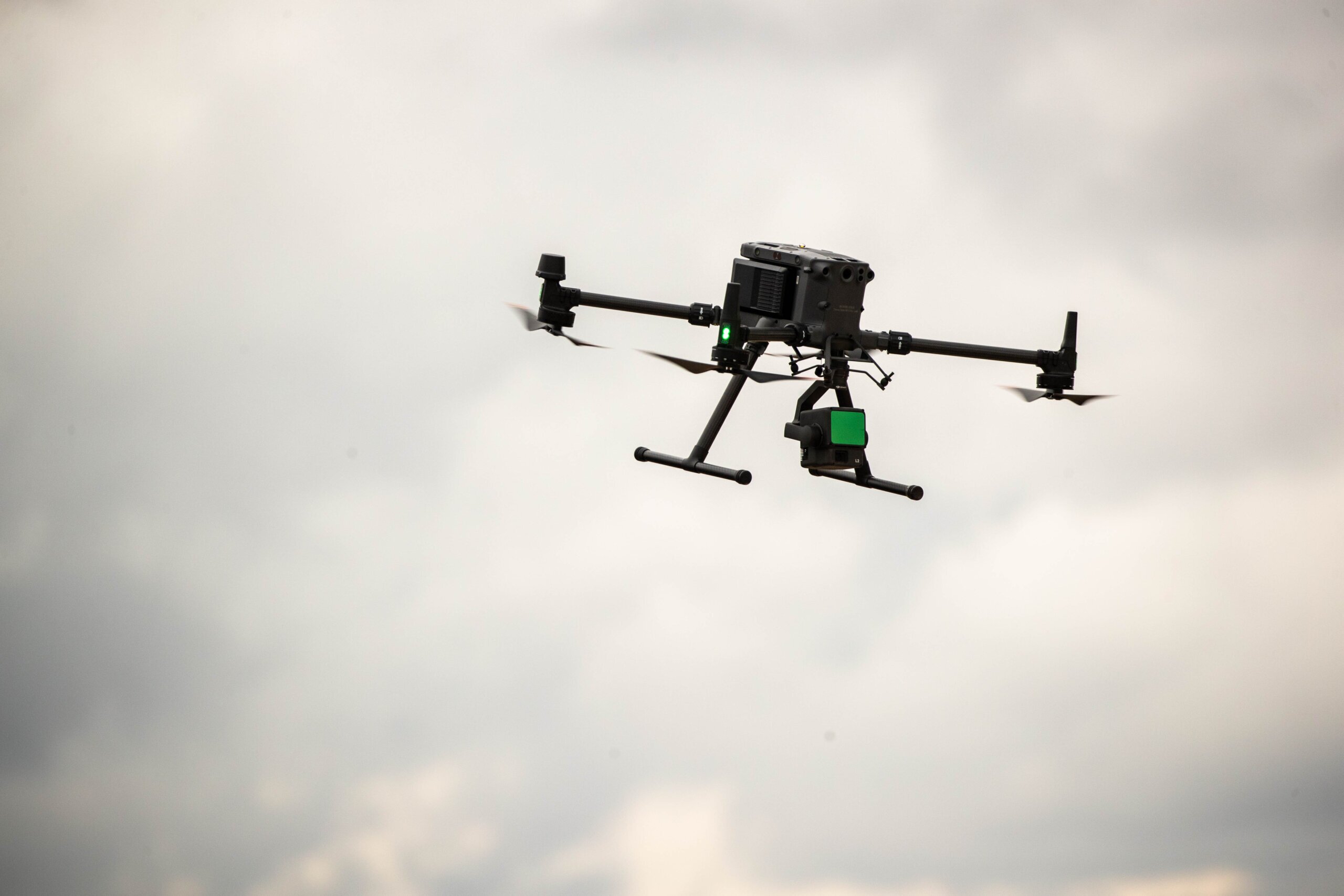
You probably know Propeller as a drone survey platform. But we’ve been hard at work over the past few years—and today, we’re so much more than that.
While drones are a huge asset on-site, they aren’t always the answer. That’s where no-drone workflows make all the difference.
In this article, we’re sharing five game-changing (and drone-free) workflows that give you the tools to work faster, reduce change orders, and keep projects on track. No drone required.
#1: Markup + Media: Bring GIS usability to your survey map
 Keep an eye on site conditions, mark off key areas, and document hazards from a single map.
With Propeller’s Media feature, you can upload site photos and 360-degree images as points on the map. Add notes for context or communicate with your team about next steps, all in one place. You don’t need a drone survey to use Media—any surface upload will work the same way, whether you’re dropping images on a hand topo, lidar scan, or even a design.
Think of Markup as an evolution of our Measurement tools, which let you mark off sections of your site to make calculations like volumes or distances. With Markup, you can freestyle any shape, anywhere on the map.
Whether you’re using your shared map for pre-bid site walks, morning safety meetings, or ongoing collaboration, Markup and Media give you an interactive way to attach images to points on the map, make specific measurements, and document hazards.
How teams use it:
A site supervisor walks a job site and spots a potential hazard, like a berm that eroded in a recent storm. Instead of making a mental note or sending several emails and texts, they simply snap a photo from the field and add it to their site in Propeller as a pin.
When crews arrive for the morning meeting, the hazard is already flagged and ready for action. You can also use Markup and Media in morning meetings to highlight work areas, draw truck routes, and mark dump locations.


#2: Progress tracking: Document site changes without waiting for a drone flight
 Track every layer of earth, every day.
Tracking progress doesn’t require a drone pilot. With Propeller, you can import hand topos, laser scans, or DirtMate surface data to verify each layer of earth as it’s moved. This helps ensure every stage of work meets specifications and prevents disputes by documenting proof of work at every step, without adding project time.
How teams use it:
A foreman needs to verify that material has been cut and compacted to the correct grade. Instead of waiting for a drone flight, they can take a quick hand topo and compare it against the subgrade design. If adjustments are needed, they can be made immediately, keeping the project on schedule and on budget.

#3: Integrated surveys: Stitch together ground-based surveys and designs
Merge multiple survey types into a single site model
You don’t need to survey your entire site every time to get a complete, high-accuracy model. With Propeller, you can merge all survey types into a single unified dataset, ensuring that your entire site is up-to-date even when flying a drone isn’t possible. This is especially useful for areas where drones can’t fly, like inside trenches or under dense tree canopies.
How teams use it:
On underground utility projects, the entire trench is almost never open at the same time. By capturing hand topos at different intervals and stitching them together in Propeller, teams get a full trench profile without needing aerial data capture.
The same idea applies in other situations where drones can’t help, such as surveying the depth of water catchment ponds. Drones can’t “see” under the water’s surface to the bottom of the pond, but ground survey hardware can. Combine aerial and non-aerial surveys—or multiple non-aerial surveys—together in Propeller for ultimate data accuracy.
#4: Compare to design: Make measurements and analyze any surface, any time
 All the power of Propeller’s easy-to-use interface, now for your designs and ground surveys
Use Propeller’s full suite of measurement and analysis tools on your ground surveys and design files, giving everyone direct access to the data they need without requiring expensive licenses or robust computer hardware.
Here’s a quick snapshot of what you can do with any surface file in Propeller—all without drone data:
- Take volume, elevation, and distance measurements
- Calculate cut-fill
- Run hydrology analysis to track runoff
- Verify as-builts against designs
- Track site progress over time
How teams use it:
A project engineer can import a hand topo and run a quick check against the subgrade design before major earthwork begins. Teams can also model water flow and drainage on any dataset (including designs), helping catch and resolve issues early.
#5: Daily productivity: Track operator and equipment performance
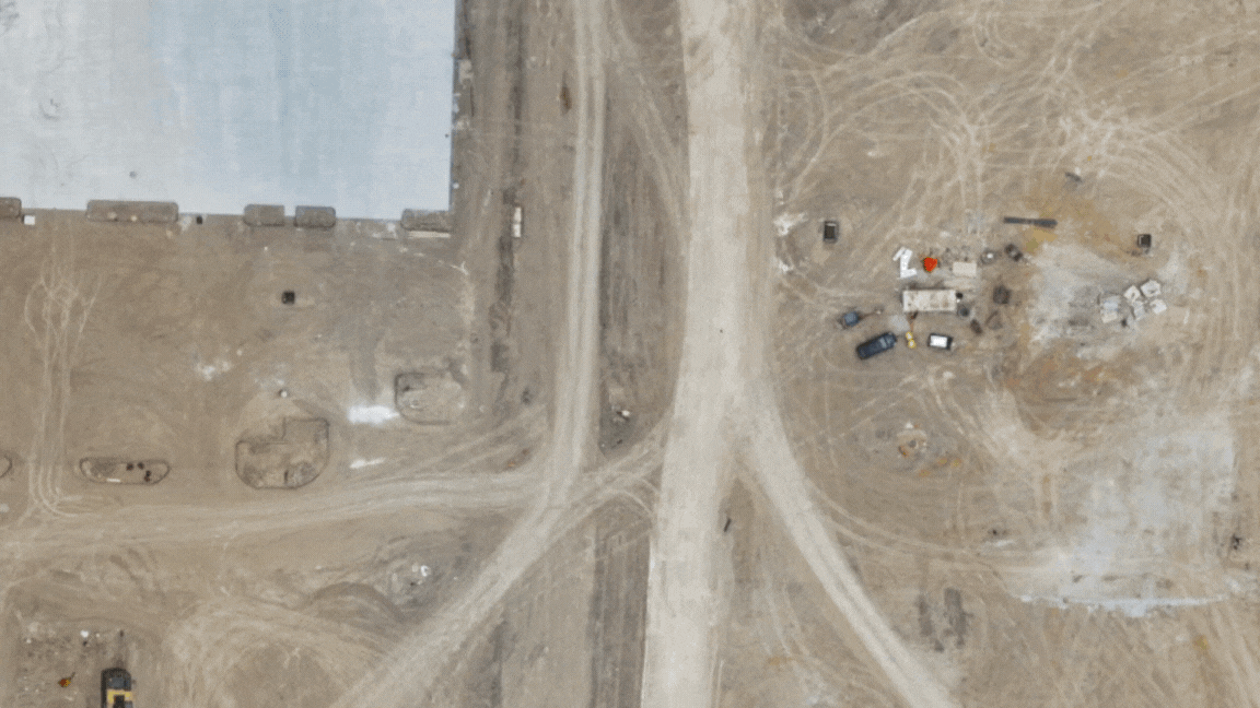
 Optimize haul routes, cycle counts, and operator performance in real time
DirtMate gives you an OEM-agnostic window into machine tracking and real-time productivity data. Just attach a DirtMate unit to any machine to track cycle counts, view haul routes, measure surfaces, and check idle time. This workflow automates site productivity tracking and helps you coach operators from afar, improving their efficiency through real-time feedback.
How teams use it:
DirtMate sensors continuously log machine activity, giving foremen and supervisors automated data on cycle counts, material movement, and operator behavior. With so much data at their fingertips, crews can review idle times and haul routes to optimize efficiency and extend equipment lifespan. For example, if trucks idle too long at the dump site, foremen can adjust haul routes or coach operators to boost efficiency and lower fuel costs.