Water damage is one of the leading causes of loss in civil construction. Major spillway failures and damaged drainage systems, such as California’s now-infamous Oroville Dam, can easily rack up repair bills in the hundreds of millions.
Proactive water management is key to preventing erosion and keeping projects on track. Whether you’re dealing with poor drainage, weather-related flooding, or dam maintenance, an unanticipated water event can result in costly delays and hazardous site conditions.
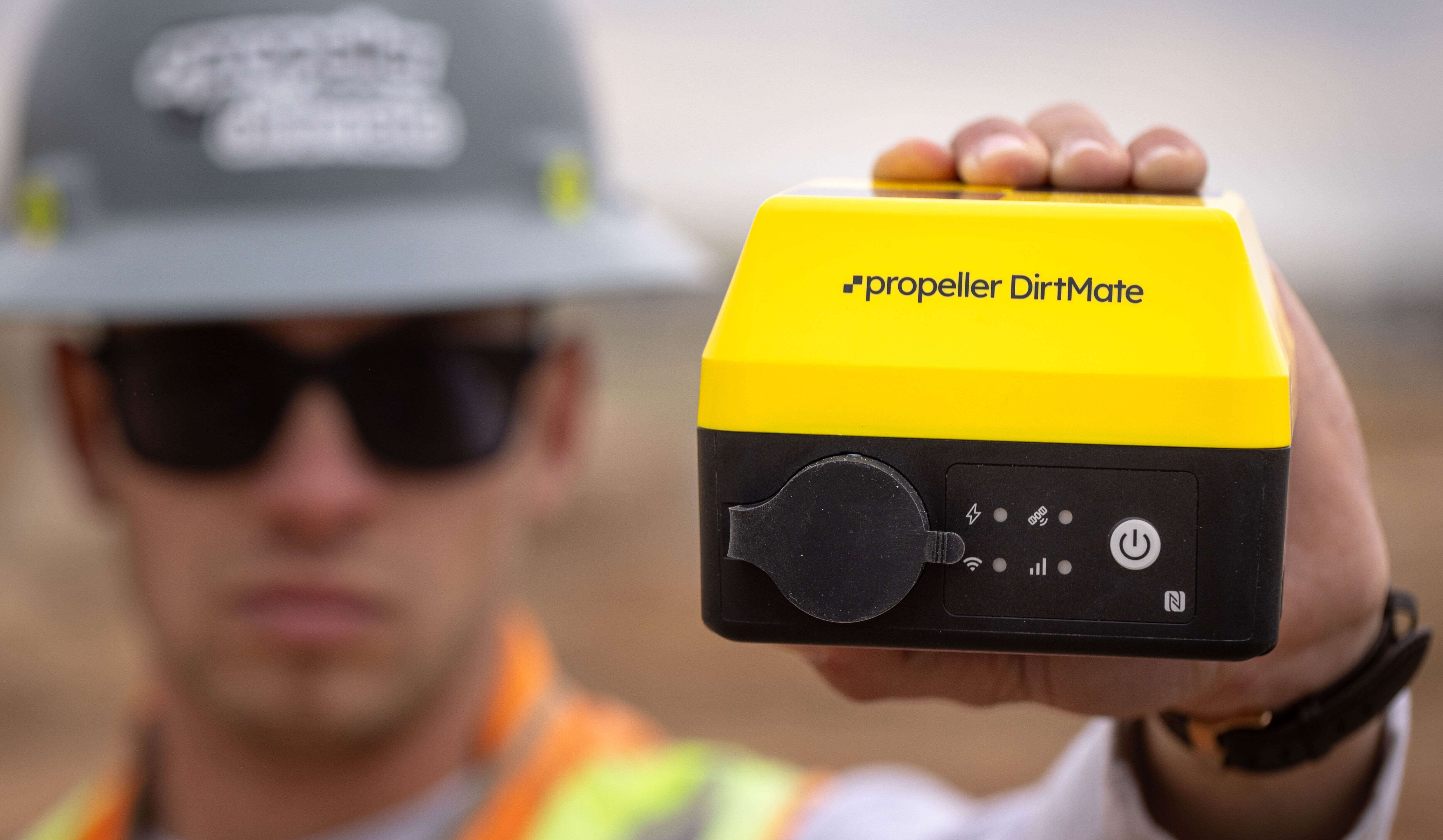
Despite the risks, most worksites deal with drainage issues after the fact instead of proactively planning for them. That’s where Propeller’s hydrology tools come in. With 3D modeling and predictive analytics, Propeller helps teams find trouble spots before they become big problems.
In this post, we’ll give you a tour of Propeller’s hydrology tools and why they’re critical for site longevity.
Predictive rainfall and runoff modeling
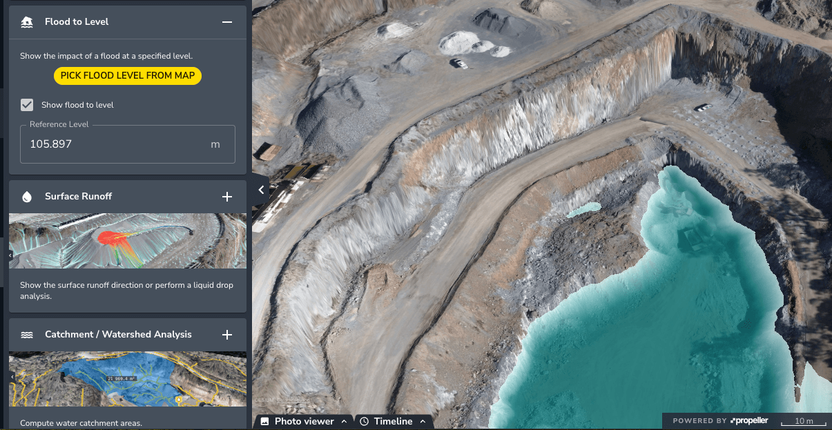
Flood to Level Analysis: Visualize the impact of rising water
Understand how rising water levels will impact your worksite.
Propeller’s Flood to Level helps you identify flood-prone areas of your worksite and plan mitigation strategies long before you need them. This helps you prevent delays caused by flooding and improve site safety by protecting equipment, stockpiles, and access roads.
Real-world example:
By simulating rising water levels after heavy rainfall, you can relocate critical equipment and reinforce drainage before a big storm hits, preventing flood damage. Flood to Level analysis has also been used to correctly assign blame in a dispute, proving that a site’s design and culvert positioning was responsible for haul road damage.
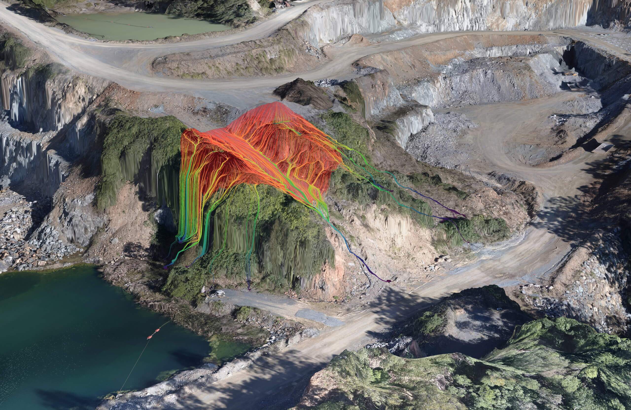
Surface Runoff Simulation: Verify proper drainage
Quickly spot pooling, drainage inefficiencies, or incorrect flow
Using Propeller’s Surface Runoff tool, you can validate on-site grading to ensure water flows as planned. When you know how water will flow, you can prevent operational disruptions that could be caused by standing water on access roads or haul routes.
Surface Runoff also helps assess and prove compliance with stormwater collection regulations, such as SWPPP.
Real-world example:
One quarry operator uses the Surface Runoff and rainfall simulator to avoid water buildup in the pit. This prevents site shutdown and de-watering costs while ensuring compliance with mine water discharge regulations.
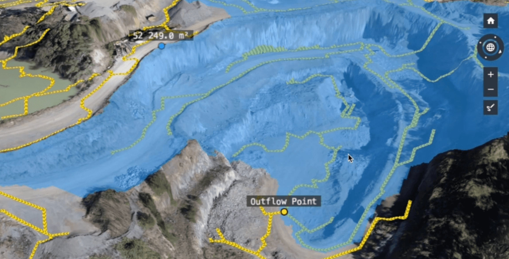
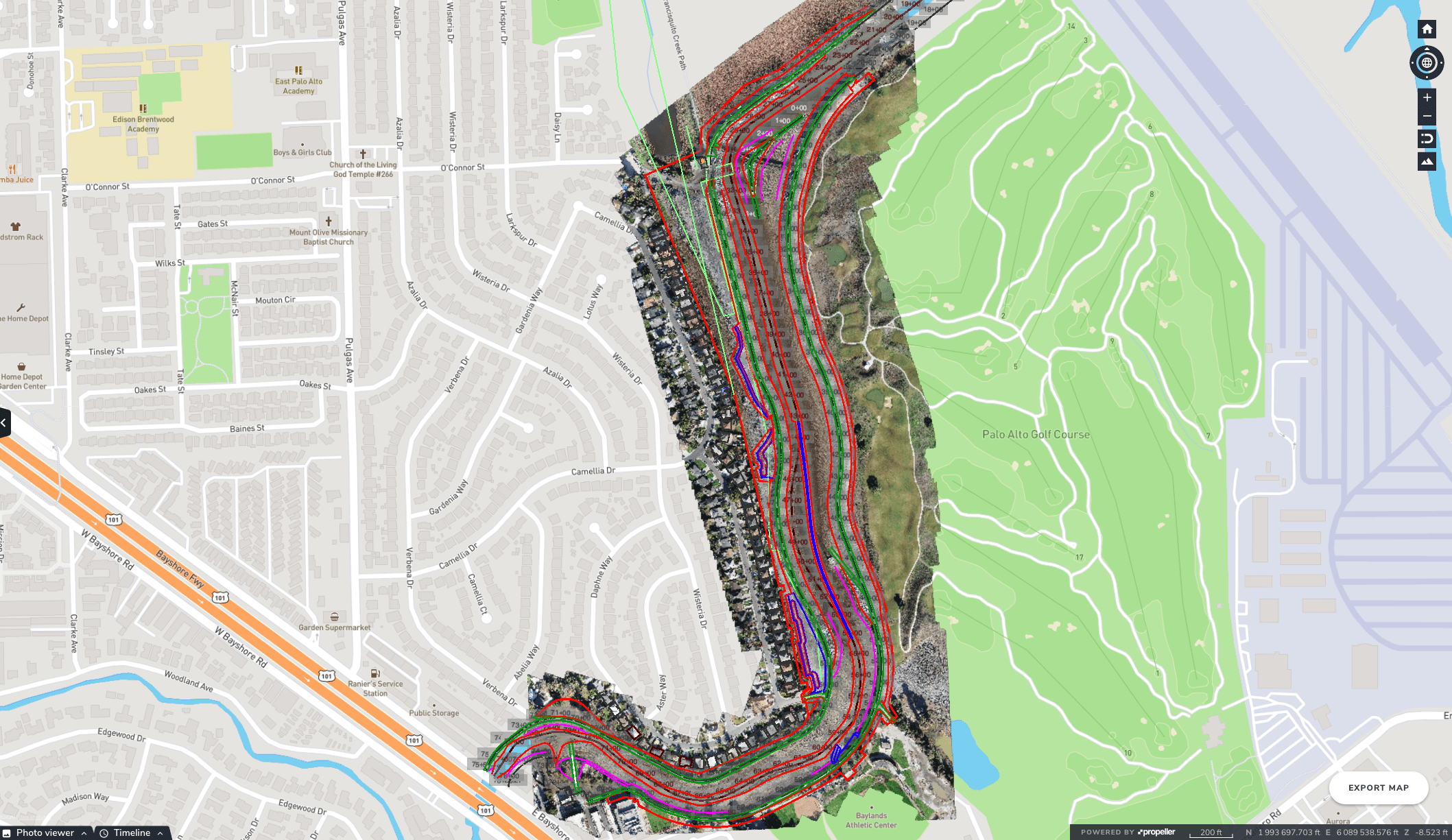
Watershed Analysis: Validate drainage networks
Understand drainage basins and visualize how water flows to outflow points
Watershed Analysis confirms whether the capacity of culverts, retention ponds, and drainage channels matches the on-site water flow that feeds them. Use this data at the design stage or while grading to redirect flow, preventing erosion or flooding in critical areas.
Real-world example:
A DOT facility that struggled with recurring flooding used Watershed Analysis to identify the root cause—a drainage system that was overwhelmed on one side. By quickly identifying the culprit, they could design a berm to reroute runoff to a different drain, eliminating their flooding issues for good.
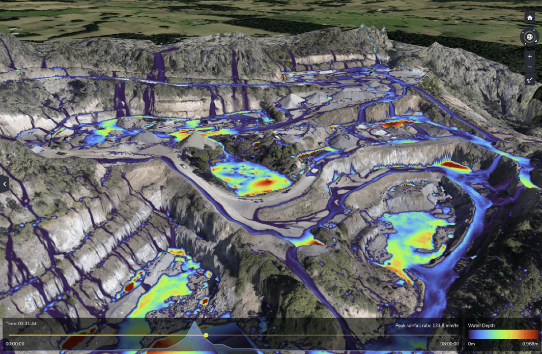
Direct Rainfall Simulation: Plan for storms before they happen
Simulate rainfall to predict low points, pooling, and potential flood zones
With Propeller’s Direct Rainfall Simulator, you get clear visuals that help you spot problem areas before they turn into (un)natural disasters. This tool will show you where to regrade, move equipment, or reinforce berms.
You can also use it to optimize site designs before you move any dirt, preventing long-term drainage issues before they start.
Real-world example:
A team redesigning a golf course used the Direct Rainfall Simulator to analyze how different levels of rainfall would impact their new course layout. Armed with this data, they could preemptively adjust slopes and drainage features to ensure optimal performance in all weather conditions.
Why use Propeller’s hydrology tools?
- Proactive water management: Don’t wait for drainage problems to slow you down before taking action. Minimize costly disruptions and rework by modeling flood risks, runoff, and watershed flow
- Keep regulators happy: Stormwater management is heavily regulated. With Propeller, you can document compliance with environmental and safety requirements
- Reduce waste: Moving more dirt than necessary is expensive. Catching drainage issues early helps reduce erosion, prevent site damage, and avoid unnecessary material waste
- Improved decision-making: Propeller’s cloud-based tools allow everyone from surveyors to site managers to access real-time hydrology data, without waiting on complex reports or second-guessing site conditions
Ready to see Propeller’s hydrology tools in action? Request a demo.