In the oil-rich regions of Texas, drilling pad construction is big business. Big D Construction is a construction company that’s served West Texas and Southeast New Mexico for over 40 years, and a large chunk of their business is building frac ponds and drilling pads for oil companies.
Adam Green, a construction technology specialist at Big D, is based in the Permian Basin where Big D’s construction team builds frac ponds, drilling pads, roads, and basic infrastructure for oil and gas operations.

For drilling pad building, time-saving is paramount
Big D needs to be able to survey a potential pad locations as efficiently as possible. In the past, Green has personally walked sites as large as 300 acres while shooting survey points every 50ft, which took five full days. Such a timeline isn’t feasible for the high-volume, fast turnaround nature of drilling pad construction.
“Once you’ve got the site data back, it can be three or four weeks to begin building or they can have equipment on site and ready to go as soon as we get the site modeled,” Green explained. So Big D turned to drone surveying and Propeller for their jobs.
Propeller saves Big D time, computing power, and money on data processing
For Green’s team, a big benefit of Propeller is not doing data processing in-house. “The ability to send pictures and a file off to Propeller and have that come back in 24 hours—that’s a major, major upside,” he said.
While some businesses see the price tag for any software and aren’t convinced it’s worth it, Green views it as an up-front cost to not process data himself.

“It’s not cheap, but it’s cheaper than buying new computers to process data and super expensive software,” he explained. “And then having to spend all the time and money to train someone on how to process all that data.”
“Propeller adds new possibilities to pretty much every aspect of my job.”
Most of Big D’s sites take less than an hour to survey with DJI’s Phantom 4 RTK drone. “If you set your
AeroPointdown as soon as you walk on site and turn it on, then go set up the drone, fly it, land it, take it all back apart and put it back in the box, you’ve got about another 20 minutes to wait for the AeroPoint to hit that 45-minute mark,” Green explained of data collection.

Most sites are in rural locations without adequate cell or internet service. This makes AeroPoints especially helpful for surveying drilling pad locations by drone. “The fact that the AeroPoint stores that data means that if you don’t have a computer or a hotspot out there, it’s perfectly okay,” he noted. “When you get back to the office, it will upload the data once it connects to the WiFi.”
3D drone maps let Big D show their customers what work was done
As a contractor on drilling pads, Big D is always sharing information and communicating with clients.
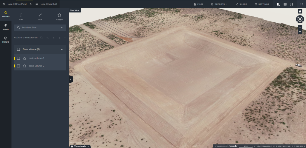
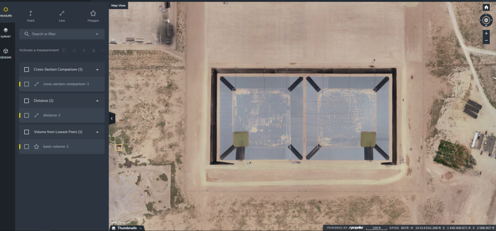
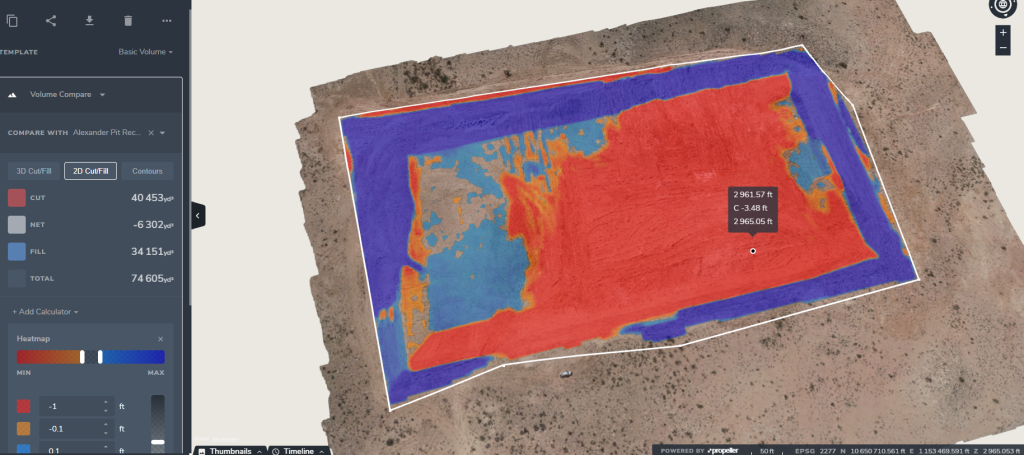
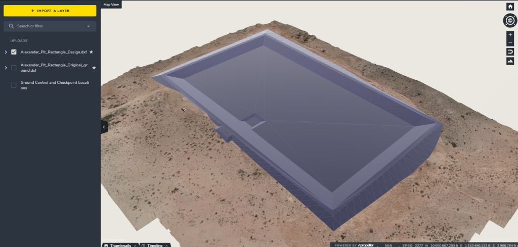
Before using Propeller, much of this information was hard to share and not very visual. But Propeller “actually gives them the visual aspect,” said Green. Now, site supervisors share measurements, volume and cut/fill comparisons, and views of linework for the pad areas.

They also use drone surveys to produce as-builts. “It gives the customers a different view than they’ve ever had before because there aren’t many people flying locations with drones,” noted Green. “If you take that drone model to a customer and say here’s your site right now, today, with an overlay of contours, linework—it’s impressive, so they want to give you more jobs.”

The visual records also expands Big D’s quality control. Having a reliable record of what the project looked like in the beginning and the end makes finding discrepancies easier. And more transparency “gives everyone a little extra motivation to take that extra step to ensure everything is tightened up after they’re done,” said Green.
Trimble Business Center integration is key for Big D’s business
Another aspect that makes a difference for Big D is Propeller’s integration with Trimble Business Center. In addition to using Trimble file formats for machine control, they, like many contractors, use Trimble equipment.
“By the time someone looks into buying a drone, they’ve probably already spent millions of dollars on Trimble software and Trimble GPS-guided heavy equipment,” he explained. “Then they’re going to spend thousands on a drone that doesn’t import into Business Center? That wouldn’t make any sense at all.”
With time saved, more jobs can be done in the same time frame
Since Big D has started using drone surveying on their drill pads, the new standard is being able to survey multiple sites in one day, as opposed to a week, allowing them to get more work done in a standard timeframe.
“When we were walking or driving, we could only do one location a day. Maybe two to three per week, depending on the size,” said Green. “With the drone, we can fly multiple locations per day.”


